|
4. Coordinate transformations |
||
|
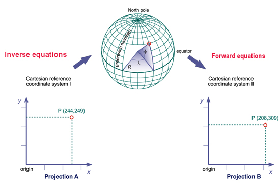
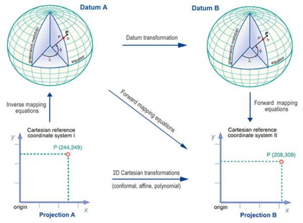
Co-ordinate transformations are
used to bring spatial data into a common reference system.
Most countries have defined their own common reference system.
For example, spatial data that are related to the Universal
Transverse Mercator projection system may need to be transformed
to the Dutch RD system if this system
is the reference system in use. This is done by converting
the UTM
|
||
|
|
|
Home | Self study : Reference sytems | Contents | Intro | 1.Graticule / topographic grid | 2.Projection Systems (a/b/c/d) | 3.Plane rectangular coordinate systems (a/b) | 4.Coordinate transfor-mations | 5.Satellite-based positioning (a/b) |