|
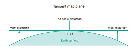
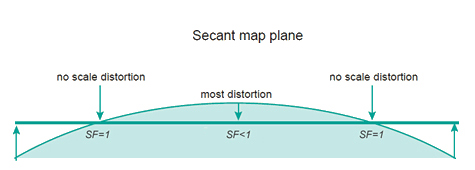
2. Projection systems - B) Scale distortions |
||
|
Source: Geometric aspects of mapping, ITC
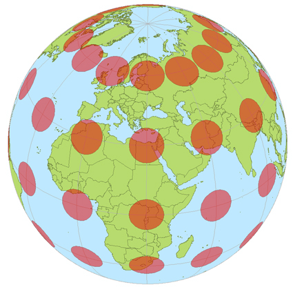
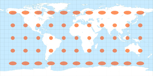
Scale distortions can be measured and shown on a map by ellipses of distortion. The ellipse of distortion, also known as Tissot's Indicatrix, shows the shape of an infinite small circle with a fixed scale on the Earth as it appears when plotted on the map.
The indicatrices on the map in the figure below have a varying degrees of flattening, and the areas of the indicatrices on the map are not the same, which means that the distortion property of the map projection is therefore equidistant.
Source: Wikipedia / Author: Eric Gaba - GNU Free Documentation License - Creative_Commons Licenses
Source: Geometric aspects of mapping, ITC |
||

|
|
|
Home | Self study : Reference sytems | Contents | Intro | 1.Graticule / topographic grid | 2.Projection Systems (a/b/c/d) | 3.Plane rectangular coordinate systems (a/b) | 4.Coordinate transfor-mations | 5.Satellite-based positioning (a/b) |