|
S03: Functions of geographical names
|
|
|
|
|
|
9. Use of names for non-cartographic purposes - continued
|
|
|
Nether = low, so Netherlands = Lowlands
= Nederland
In the Netherlands lived two tribes in Roman times (50 AD),
the Batavi and the Belgae. Around 1600 the federation of northern
provinces were called in Latin: Belgium Foederatum. Around
1800 AD the Northern part of the Netherlands was called Batavian
Republic, its main headquarter overseas was called Batavia;
when the Southern part of the Netherlands became independent
in 1830 it called itself after the other tribe, Belgium.
-
Descriptive
names
-
Use
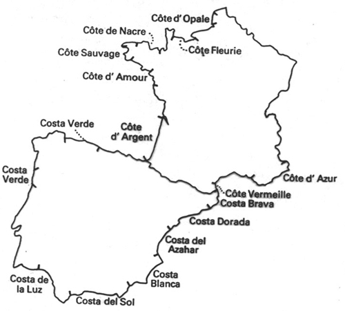
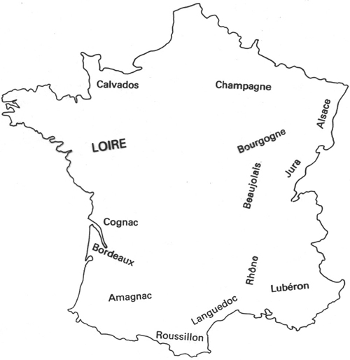
of geographical names as brand names
Different types of wine,
cheese or liquor are called after the region where they are
produced:
-
Use of names
as symbols
-
Rome
= empire
-
Bonn,
Pankow = cold war
-
Stalingrad,
Vietnam = batles
-
Trianon,
Saint Germain = traumatic peace treaties
-
Bali
= tropical paradise
-
Paris
= city of light, city of style
-
Venice
= water-city
- Siberia =
inaccessible
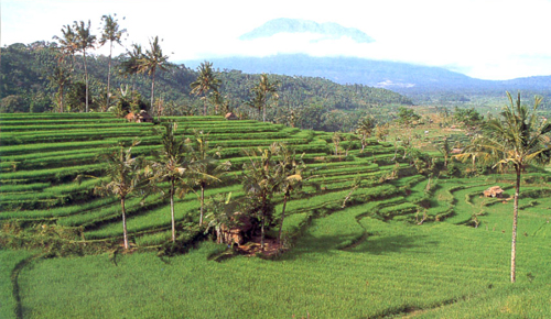
The name Bali is the symbol
for a tourist paradise. Because of a bomb attack, it refers
now to a threatened paradise.
-
Use
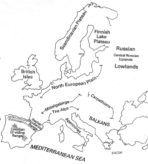
of names for educational purposes
Educational names are used in
order to explain topography and not for reference purposes:
- Use of names for traffic/transportation
Names of bus stops, train stations or post offices
are standardised because they also figure in time tables or
lists of telegraph offices where telegrams used to be sent.
It was so important that no ambiguity existed in the spelling
of these names, that they were the earliest to be standardised.
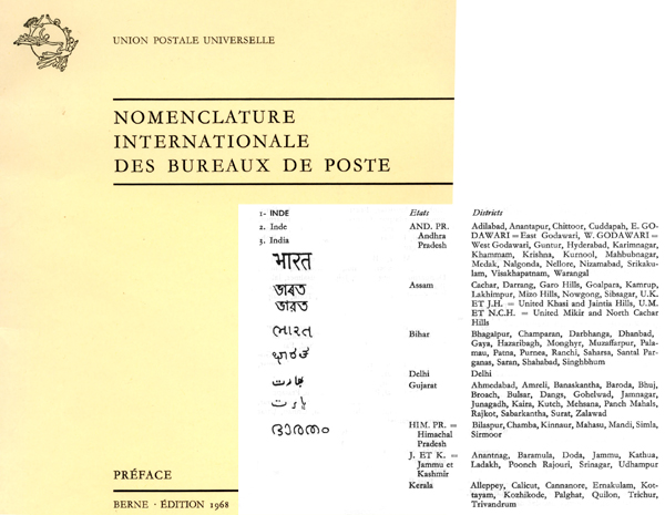
Dictionnaire des bureaux de poste:
All the post offices in the world are
listed in their proper spelling.
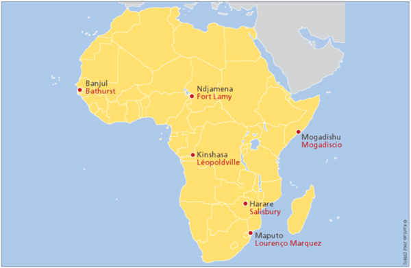
Decolonisation of African place names: red
names are former colonial names.
|
  |
|
|
|
|
|
|
|