|
S14: Toponymical Guidelines
|
|
|
|
|
|
2. the scope - a) Language
|
|
|
What issues are dealt with here?
-
What is the official language?
-
Is there one nation-wide official language, or are there more?
-
Are there languages that are official on a sub-national level? What is their alphabet and pronunciation?
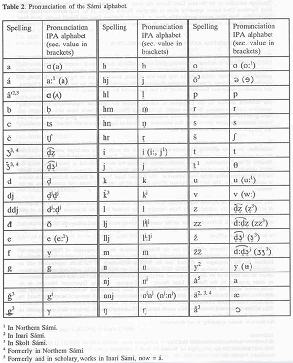
Example of the Northern Sámi alphabet from the Norwegian Guidelines:

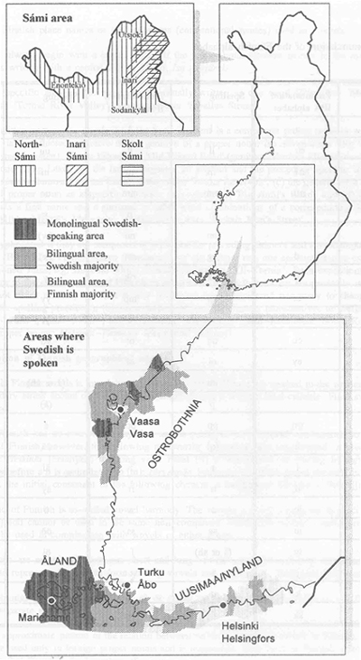
Sample maps showing the extent of Sámi- and Swedish-speaking minorities in Finland:
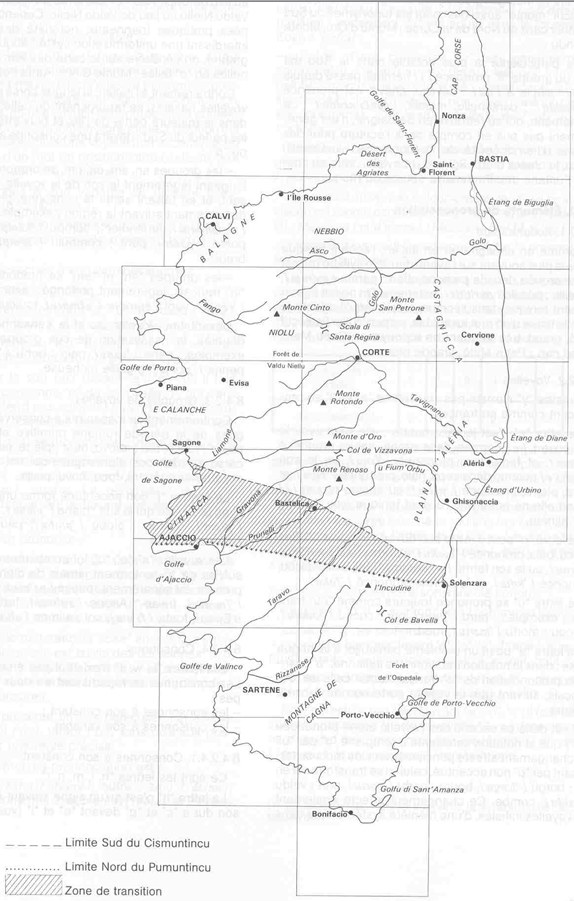
Sample maps showing the extent of Basque- and Corsican-speaking minorities in France:

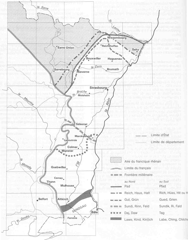
Sample map showing the extent of German dialects in France:
Sample maps showing the extent of Danish- and Sorbian-speaking minorities in Germany:

-
What is the national language?
-
What is the exact status of the different languages, both nationally, regionally, and locally?
-
Are there substrata of other languages visible?
-
Is there a subdivision into dialects which is relevant for placenames?
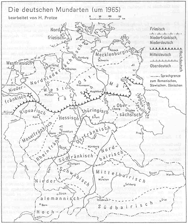
Dialects in Germany:
Dialects and minority languages in France:

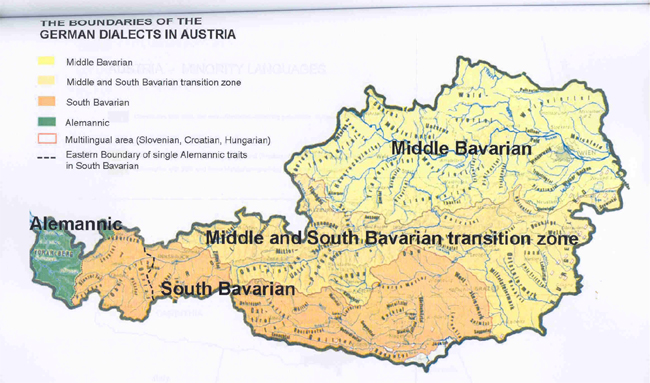
Dialects and minority language areas in Austria:
In Austria:
-
German is the only nation-wide official language.
-
Minority languages play a subordinate role, and are of regional and local importance only.
-
Standard German is the national language.
-
The main dialects belong to the Alemannic (Vorarlberg and some parts of Tyrol) and Bavarian dialect groups (the rest of the country) of the Germanic languages.
-
The main characteristics of the dialects, and their historic background, are summarized.
-
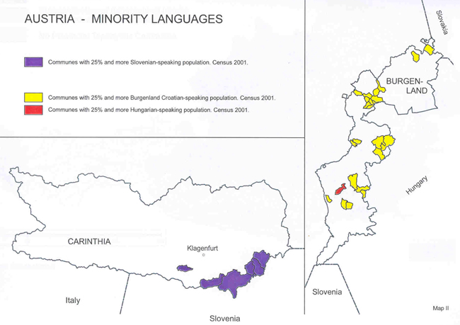
Austria officially recognizes four minority languages: Slovenian (in Carinthia), Burgenland Croatian (in Burgenland), Hungarian (also in Burgenland), and Czech (in Vienna).
-
A map is enclosed.
-
The alphabets of these languages, and in the case of Burgenland Croatian (native to Austria only) a pronunciation key, are presented, and their official and de facto status for toponymic use is explained.
Back to the checklist of Toponymic guidelines
|
  |
|
|
|
|
|
|
|