|
S15: Toponymical data files
|
|
|
1. Gazetteer of the netherlands |
||
|
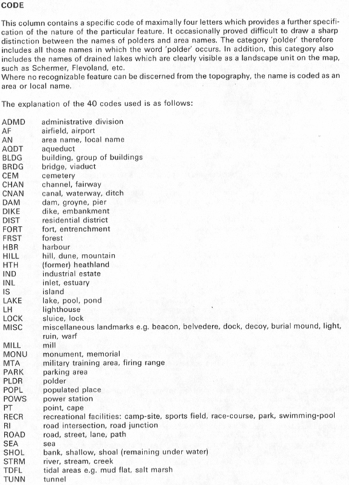
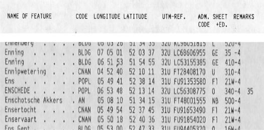
This gazetteer contains the names, their feature codes, their geographical co-ordinates (longitud, latitude), their UTM references, an administrative code (the letters refer to the provinces of the Netherlands), a reference to the map sheet and edition the names were taken from and a column for remarks. The following feature codes are used: Entries
|
||

|
|
|
Home | Selfstudy : Toponymical data files | Contents | Intro | 1.Dutch example | 2.German example | 3.Geographical Names Data Bases | 4.Number of entries | 5.Contents | 6.Types | 7.Sources | 8.Digital names data bases |
Copyright United
Nations Statistics Division and International Cartographic Association, July 2012